News
Imagery from Chaohu-1 SAR Satellite Unveiled
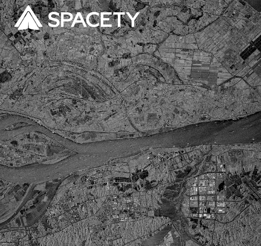
One week after the successful launch of our new Synthetic Aperture Radar (SAR) C-band satellite, we received the first images showing a very good quality. These images cover typical landscape areas clearly showing mountains, fields, rivers, lakes and cities. All the images have very good spatial and radiometric resolutions. We have now reached the highest resolution available from any commercial C-band SAR small satellite.
These images not only demonstrate Spacety’s capabilities of building a SAR constellation but also lay a solid foundation for the deployment of Spacety’s upcoming SAR satellite, the 3rd of our SAR constellation. During 2022, we plan to launch more SAR satellites while also enabling InSAR related applications. This will make Spacety the world’s 1st commercial company to provide InSAR imagery data using C-band small satellites.
Meanwhile, Spacety has also been accelerating the capabilities for providing end users with accurate and customized satellite remote sensing services. We have been establishing a comprehensive and efficient global Earth observation and data acquisition capacity thereby contributing to the advancement of many applications as well as to a global emergency response system.
In addition, Spacety will speed up building capabilities of providing end users with accurate and customized satellite remote sensing services while establishing a comprehensive and efficient global Earth observation and data acquisition capacity thereby contributing to China as well as global emergency response system.