News
Six Satellites in One Launch!
SPACETY’s 20th Space Mission Achieves Complete Success!
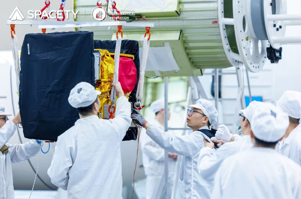
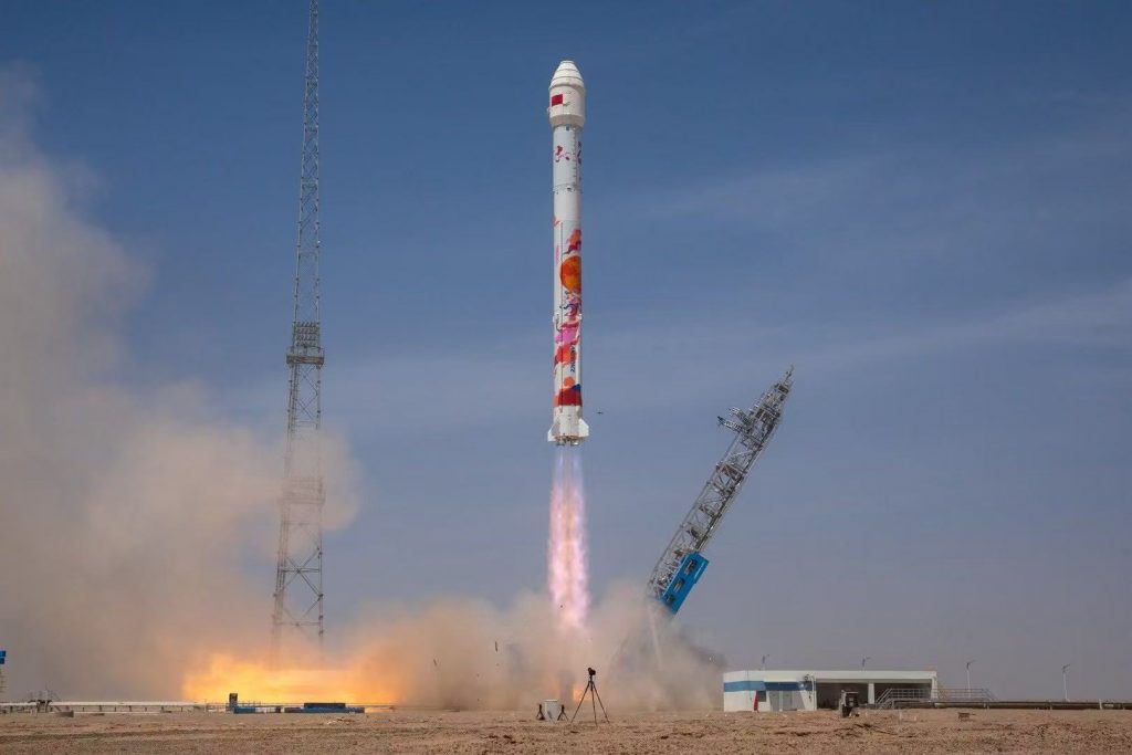
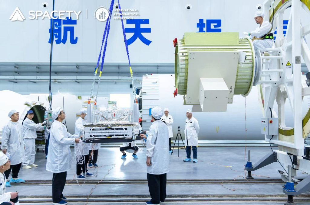
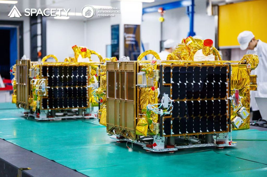
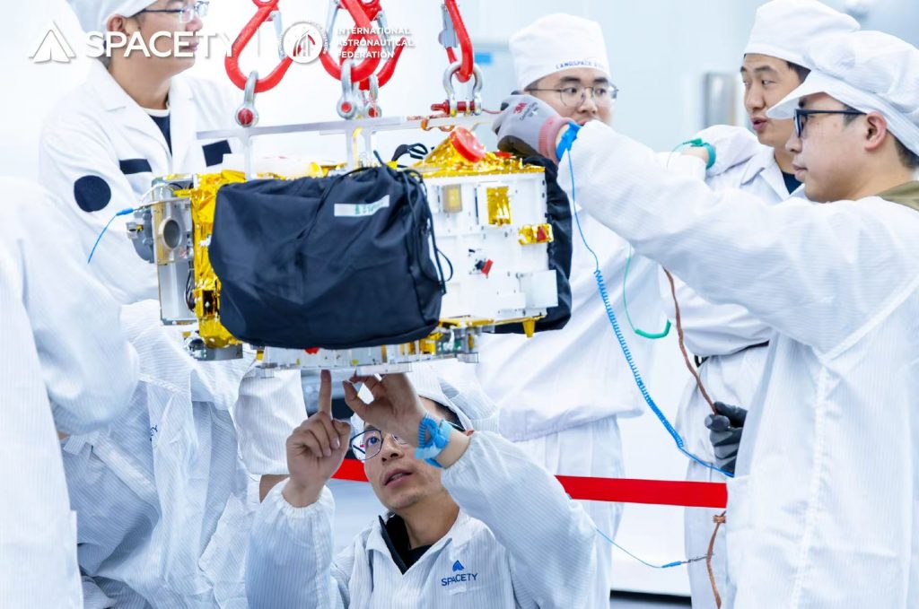
At 12:12 Beijing time on May 17, 2025, six commercial satellites developed by SPACETY were successfully launched aboard a Zhuque-2A (ZQ-2A) modified carrier rocket from the Dongfeng Commercial Aerospace Innovation Test Zone.
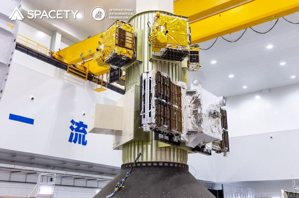
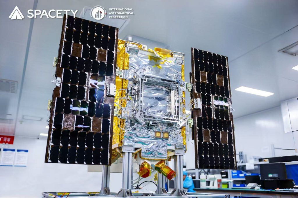
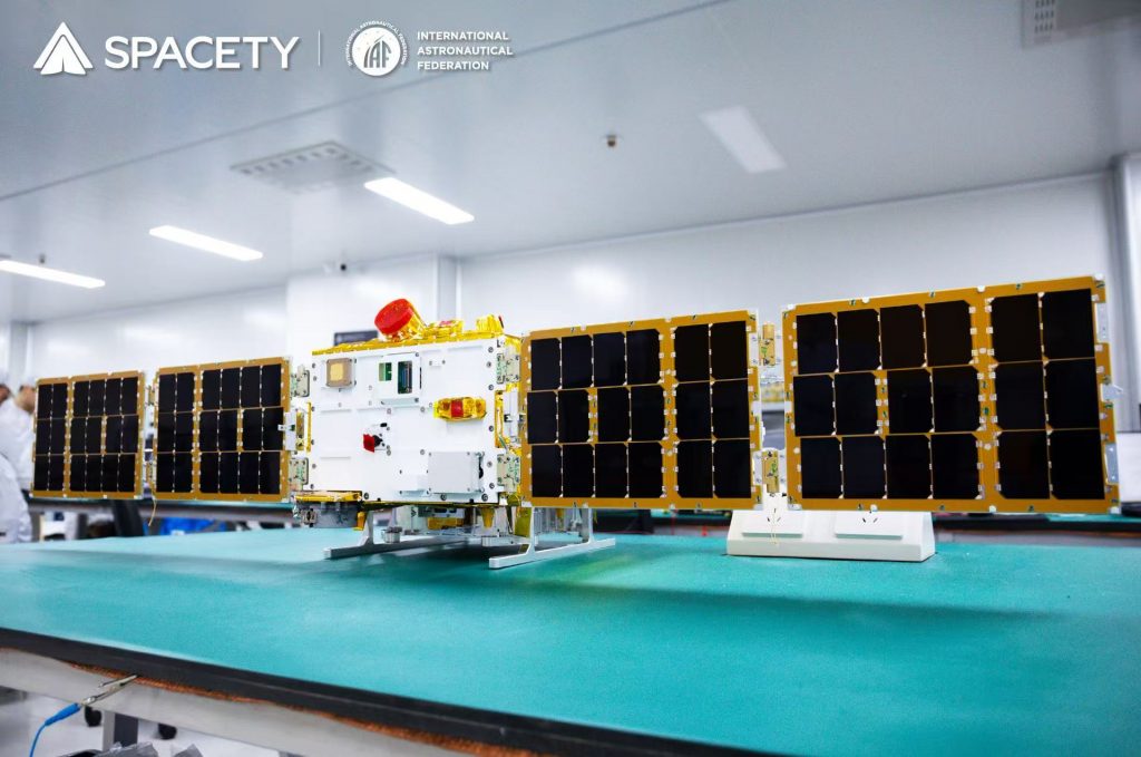
The six satellites cover multiple application fields, including one commercial SAR remote sensing satellite TY42 (Shenqi-2), two optical remote sensing satellites TY29 (DIZHI-1) and TY35 (NCHU-1), and three space science experimental satellites TY34 (SUSTech-1), TY45 (BUPT-2), and TY46 (BUPT-3). After precise orbital insertion, all telemetry parameters were normal, with solar panels and antennas deploying smoothly, marking the complete success of the mission.
1、A New Global Benchmark for InSAR Satellites: Advancing Operationalization of Surface Deformation Interferometry
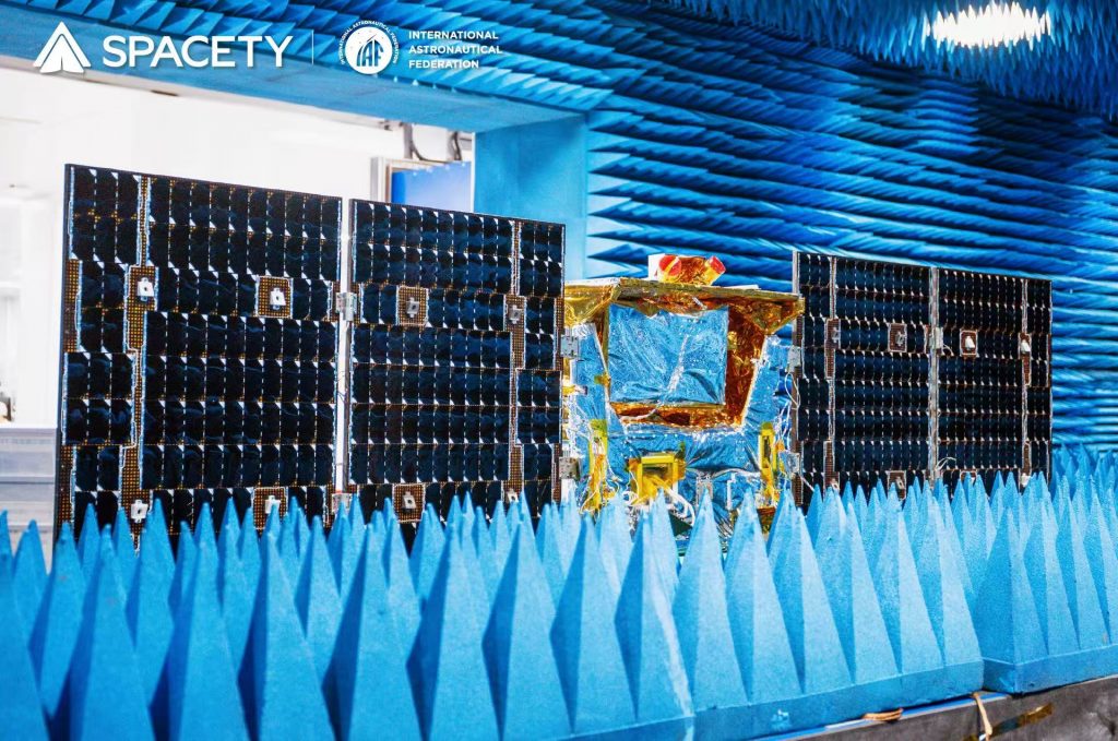
TY42 (Shenqi-2), the mission’s centerpiece, is a lightweight, low-cost, high-performance C-band SAR satellite jointly developed by SPACETY and Zhangye Constellation Space Technology Co., Ltd. Equipped with SPACETY’s next-generation Synthetic Aperture Radar (SAR) payload, it achieves internationally advanced technical specifications, enabling all-day, all-weather Earth observation and stable acquisition of high-resolution imagery under complex meteorological conditions.
TY42 also features operational Interferometric SAR (InSAR) capabilities, enabling millimeter-level surface deformation monitoring. With broad application value in natural resource management, water conservancy, power grids, infrastructure monitoring, marine and coastal surveillance, and disaster emergency response, it provides global users with regular, high-quality, and independently controllable commercial SAR data services.
Upon orbital deployment, TY42 will collaborate with Shenqi-1 and Fucheng-1 to perform repeat-pass interferometric imaging, delivering global operational InSAR services with a 3-4 day revisit cycle.
2、New Optical Remote Sensing Tools: Pioneering Advances in Geological Exploration and Environmental Monitoring
TY29 (DIZHI-1) and TY35 (NCHU-1) are two optical remote sensing satellites.
TY29, led by China University of Geosciences (Wuhan), is a hyperspectral geological remote sensing intelligent small satellite. Its spectral bands (410nm-2480nm) are meticulously optimized for geological applications, forming specialized spectral coverage for the industry.
Furthermore, TY29 (DIZHI-1) has overcome multiple critical technical challenges, including high-reliability integrated optomechanical system design, high-reliability infrared focal plane filter spectral splitting technology, and Time-Delay Integration (TDI) multi-spectral visible light detection technology for the camera. These breakthroughs provide robust technical foundations for the efficient application of satellite data in geological and environmental remote sensing. TY29 (DIZHI-1) is capable of delivering high-precision remote sensing data and professional analytical services for geological and environmental exploration, monitoring, identification, interpretation, and analysis. Its applications span mineral composition detection, rock type identification, alteration information extraction, soil quality assessment, and water pollution monitoring. Through these high-quality datasets and services, TY29 (DIZHI-1) will empower scientists to more accurately decipher Earth’s geological structures, offering strong scientific evidence and technical support for resource exploitation, environmental protection, and disaster prevention.
TY35(NCHU-1), developed under the leadership of Nanchang Hangkong University, is an intelligent multispectral ecological environment monitoring satellite. Its platform demonstrates significant advantages in autonomous operation and intelligent control. The onboard multispectral camera employs an advanced off-axis three-mirror optical system, with optical parameters such as focal length, field of view, F-number, aperture, spectral range, and band selection meticulously optimized to enhance imaging performance and quality.
Equipped with a high-quantum-efficiency, low-noise CMOS detector, TY35 supports real-time monitoring and rapid response, particularly excelling in water pollution detection, water quality analysis, and algal bloom monitoring. Additionally, it is applicable to terrestrial environmental remote sensing, including soil and vegetation monitoring, providing comprehensive data support for regional sustainable development goals.
SPACETY will collaborate with Shenqi-02 from the Zhangye SAR Constellation and the two optical satellites above to validate optical-SAR synergistic technologies in orbit. This will enable high-efficiency fusion and precise utilization of dual-mode remote sensing data, improving the completeness, accuracy, and timeliness of Earth observation data in complex environments. These advancements will strengthen support for disaster emergency monitoring, environmental surveillance, and dynamic resource assessment.
3、Cutting-Edge Space Testbed: Setting New Records in In-Orbit Technology Verification and Deep Space Exploration
TY45 (BUPT-2) and TY46 (BUPT-3) are the second batch of satellites in the Tiansuan Constellation, developed under the leadership of Beijing University of Posts and Telecommunications (BUPT).
Both satellites are equipped with 200Gbps laser communication payloads (communication range: 2,000 km), space servers, on-board computing units, and Kaufman electric propulsion systems. They will conduct in-orbit verification of multiple frontier aerospace information technologies, including:
- 6G intelligent semantic communication transmission
- 6G space-based core network architecture testing
- Reliability and performance evaluation of on-board containerized systems
- High-speed space-to-ground data link protocol validation
- Quality-of-service testing for IP-based real-time audio/video transmission
- On-board IoT time-series database management system trials
- Energy-efficient, thermally-aware satellite image processing
These technologies collectively advance the vision of “Space-Earth Integrated Computing”, contributing innovative solutions to national space infrastructure development.
TY45 utilizes the Xingcheng-II argon ion thruster (specific impulse: 1,600 seconds) developed by Xingcheng Huiyu (Beijing) Technology Co., Ltd., designed for precise orbital control and end-of-life deorbiting. This mission also conducts the thruster’s third in-orbit ignition test, orbital maneuver test, and longevity validation, providing technical insights for future iterations.
TY34 (SUSTech-1), the first space science microsatellite of Southern University of Science and Technology (SUSTech), carries a self-developed space electric field measurement payload and aurora camera, along with Tiange payload (gamma-ray burst detector), Guangxi University’s CXPD payload (X-ray polarimeter), SPACETY’s self-developed IP-based ground-link terminal, and Thermoelectric conversion verification unit.
The space electric field measurement payload utilizes an antenna to detect time-varying electric fields in space plasma, providing critical capabilities for monitoring Earth’s magnetosphere and ionosphere. This payload marks the world’s first deployment of an ultra-long electric field antenna (up to 12 meters) on a microsatellite platform, setting a new record for electric field antenna length in microsatellites. This breakthrough enables high-precision electric field measurements on small satellites, offering a novel solution for advancing China’s deep space exploration technologies.
The aurora camera payload employs an onboard camera to real-time capture large-scale aurora observation data, imaging auroral phenomena in high-latitude regions. This payload represents China’s first attempt to conduct optical aurora observations using a microsatellite platform. Through precise orbital design, TY34(SUSTech-1) achieves 9 minutes of continuous observation during each polar pass. Equipped with a high-sensitivity aurora camera, it dynamically records auroral morphology evolution, generating key datasets to unravel the mechanisms of solar wind-magnetosphere interactions.
During in-orbit operations of the two payloads, TY34(SUSTech-1) will focus on studying solar wind-magnetosphere coupling and space weather effects, delivering critical data to enhance space weather forecasting accuracy and ensure the safety of spacecraft operations.
Furthermore, SPACETY will leverage these three scientific satellites to validate a series of self-developed key technologies, including: Real-time IP-based space-ground data interaction, Thermoelectric energy conversion and Attitude control for inter-satellite laser communications.
These efforts will comprehensively advance satellite platform capabilities in intelligent measurement and control, energy-efficient utilization, and high-speed inter-satellite data transmission, laying a robust technical foundation for future high-performance SAR satellite constellations and their operations.
4、Commercial Aerospace Milestone: Six-Satellite Batch Launch Empowers Full-Cycle Industrial Ecosystem Development
This mission is SPACETY’s first six-satellite launch and its 20th space mission, completing the systematic deployment of 37 satellites. This achievement signifies a transformative leap from single-satellite technology verification to batch production, while establishing the world’s first full-cycle industrial ecosystem for C-band commercial SAR satellites, encompassing satellite design, constellation operation and maintenance, and data services.
Meanwhile, the launch also demonstrated SPACETY’s full-range satellite platforms spanning 20kg to 300kg-class, marking a new phase in small satellite technology development and the beginning of satellite industrialization. SPACETY remains committed to innovating remote sensing and scientific satellite platforms, continuously advancing core technologies in cost reduction, modular design, and intelligent operations, while driving iterative upgrades in commercial small satellite systems.
In the future, SPACETY will focus on providing end-to-end technical support for large-scale SAR constellation operations, building a high-reliability, high-performance SAR service system. This initiative will fully empower space technology innovation and industrial ecosystem development, contributing to China’s vision of becoming a global leader in science and technology.